Suche einschränken:
Zur Kasse

605 Ergebnisse - Zeige 1 von 20.

Rand McNally Easy to Fold: Minnesota State Laminated Map

Rand Mcnally
Rand McNally Easy to Fold: Minnesota State Laminated Map
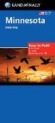
The durable and convenient Minnesota Easy To Fold state map will take all the wear and tear your journey can dish out. The heavy-duty laminated design allows you to mark your route, make notes, then wipe the surface clean for further use. This is a must-have for navigation whether you're a state resident or just passing through. -Easy to fold means no fumbling. -Heavy-duty lamination allows you to write on, wipe off. -Durable and tear resistan...

Rand McNally Easy to Fold: Pennsylvania State Laminated Map

Rand Mcnally
Rand McNally Easy to Fold: Pennsylvania State Laminated Map
The durable and convenient Pennsylvania Easy To Fold state map will take all the wear and tear your journey can dish out. The heavy-duty laminated design allows you to mark your route, make notes, then wipe the surface clean for further use. This is a must-have for navigation whether you're a state resident or just passing through. -Easy to fold means no fumbling. -Heavy-duty lamination allows you to write on, wipe off. -Durable and tear resis...

Rand McNally Folded Map: New York City 5 Boroughs Street Map

Rand Mcnally
Rand McNally Folded Map: New York City 5 Boroughs Street Map
Rand McNally's folded map for New York City 5 Boroughs: Manhattan/Bronx/Brooklyn/Queens/Staten Island is a must-have for anyone traveling in and around this part of New York, offering unbeatable accuracy and reliability at a great price. Our trusted cartography shows all Interstate, U.S., state, and county highways, along with clearly indicated parks, points of interest, airports, county boundaries, and streets. The easy-to-use legend and deta...

CHF 15.90

Rand McNally Folded Map: Philadelphia & Southeast Pennsyl...

Rand Mcnally
Rand McNally Folded Map: Philadelphia & Southeast Pennsylvania Regional Map
Rand McNally's folded map for Philadelphia & Southeast Pennsylvania is a must-have for anyone traveling in and around this part of Ohio, offering unbeatable accuracy and reliability at a great price. Our trusted cartography shows all Interstate, U.S., state, and county highways, along with clearly indicated parks, points of interest, airports, county boundaries, and streets. The easy-to-use legend and detailed index make for quick and easy loc...

CHF 14.50

Rand McNally Folded Map: Houston Street Map

Rand Mcnally
Rand McNally Folded Map: Houston Street Map
Rand McNally's folded map for Houston is a must-have for anyone traveling in and around this part of Texas, offering unbeatable accuracy and reliability at a great price. Our trusted cartography shows all Interstate, U.S., state, and county highways, along with clearly indicated parks, points of interest, airports, county boundaries, and streets. The easy-to-use legend and detailed index make for quick and easy location of destinations. You'll...

CHF 15.90

Rand McNally Folded Map: Philadelphia Street Map

Rand Mcnally
Rand McNally Folded Map: Philadelphia Street Map
Rand McNally's folded map for Philadelphia is a must-have for anyone traveling in and around this part of Pennsylvania, offering unbeatable accuracy and reliability at a great price. Our trusted cartography shows all Interstate, U.S., state, and county highways, along with clearly indicated parks, points of interest, airports, county boundaries, and streets. The easy-to-use legend and detailed index make for quick and easy location of destinat...

CHF 14.50